
Press
SurveyDeliver opened to the public on 2 October 2026. Everything on this page may be used freely with a credit to SurveyDeliver.
The news
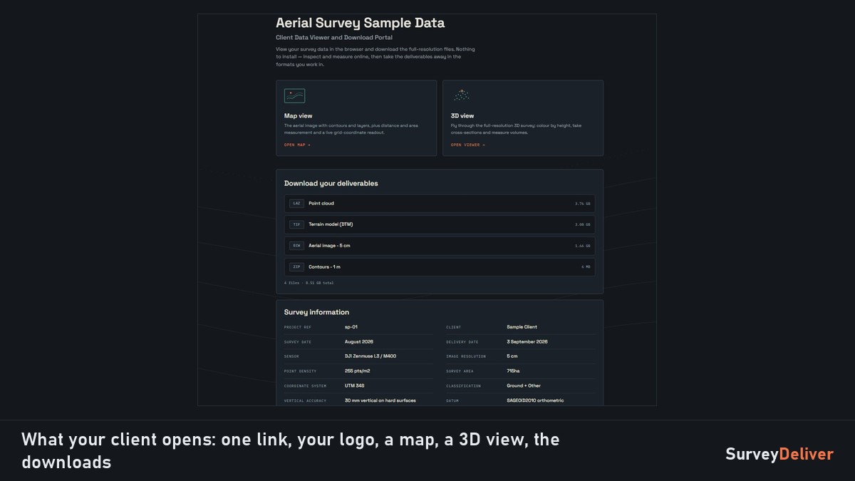
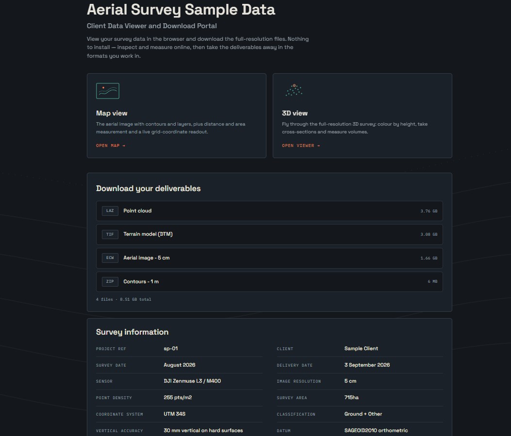
SurveyDeliver (surveydeliver.io) is a web service for drone and land survey operators. They upload the files they already export from their processing software, and their client receives one branded link with a map they can measure on, a 3D view of the point cloud and every file to download. Nothing is installed on either side.
It was built by 3DroneMapping (Pty) Ltd, a drone LiDAR survey company in South Africa, for its own deliveries first, and is now sold worldwide with a 14-day trial.
The problem it solves
A survey ends with gigabytes of orthomosaics, elevation models, contours and point clouds. The client usually has nothing that opens them, and the operator either sends a download link and fields the questions, or spends a day tiling imagery, converting the point cloud and standing up a web map. The last step of the job is the one that looks least professional.
What it does
- Takes the formats operators already export: GeoTIFF orthomosaics and elevation models, LAS/LAZ point clouds, shapefiles, DXF, GeoPackage, GeoJSON and KML, plus any other file as a download.
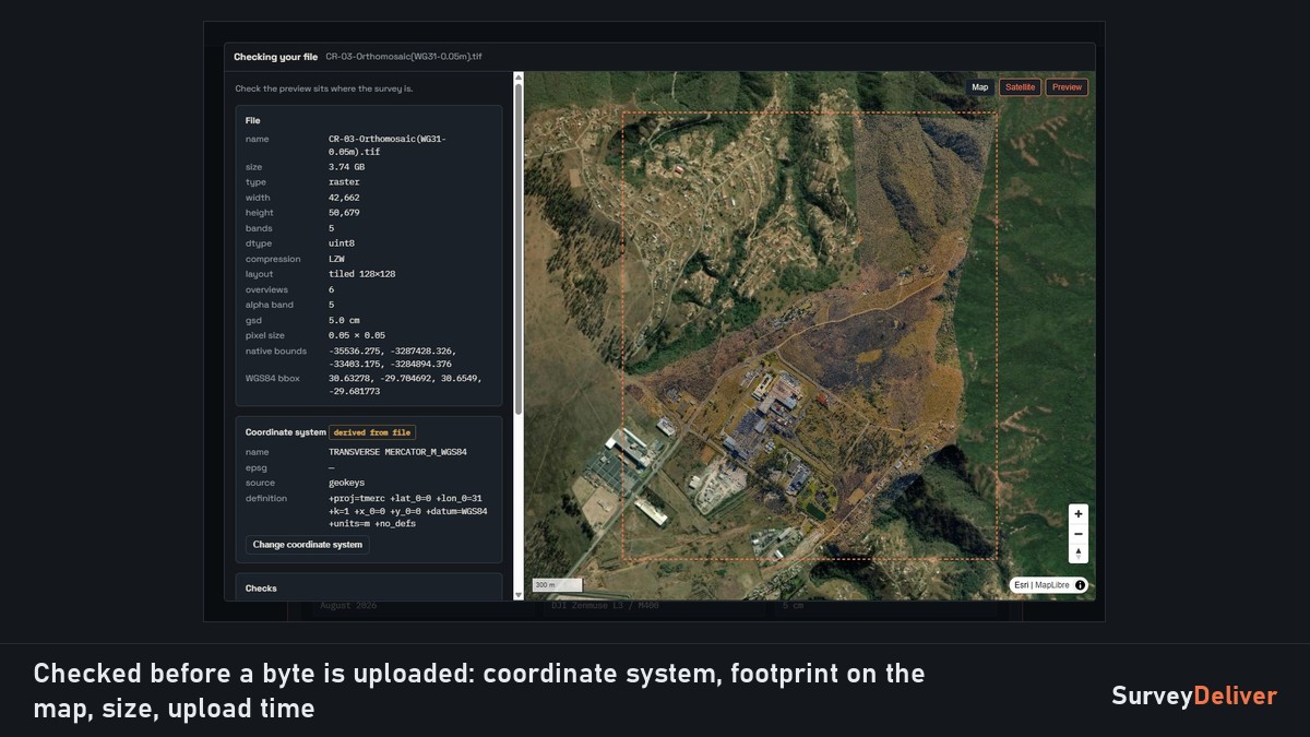
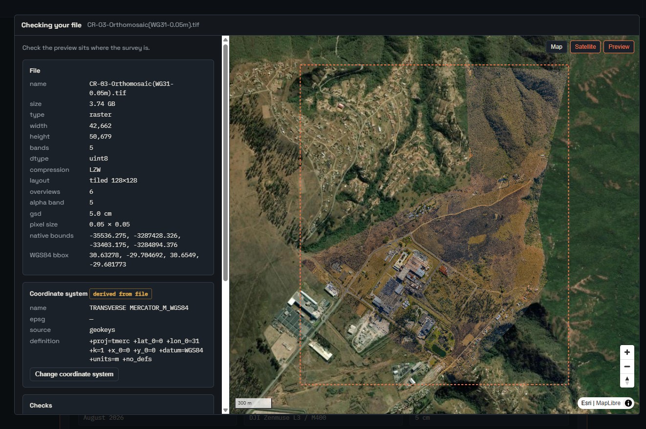
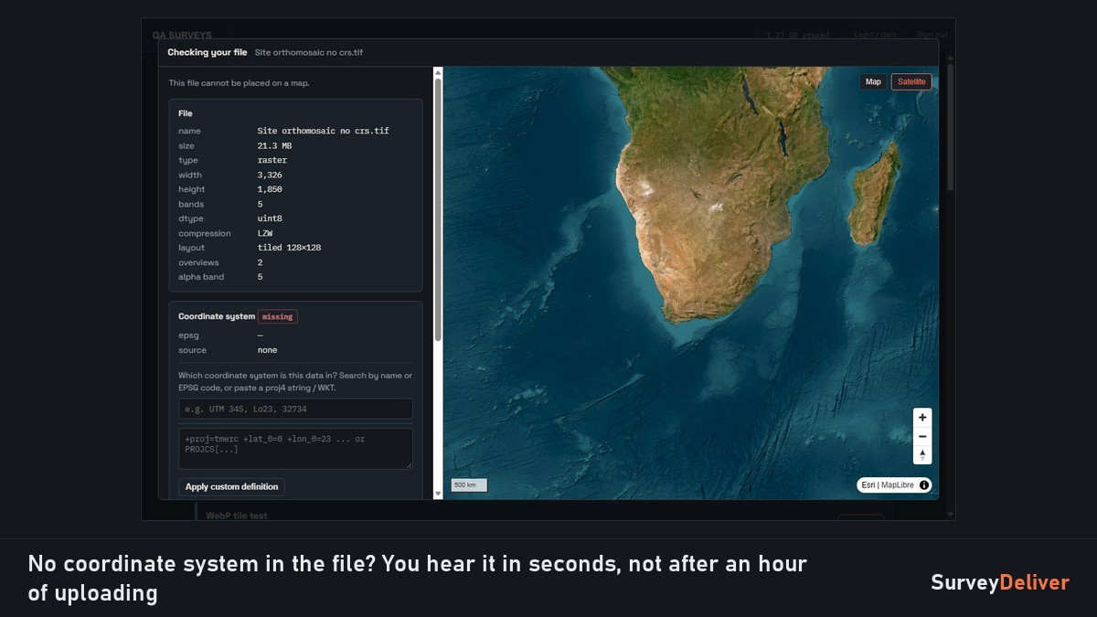
- Checks every file in the browser before it is uploaded: coordinate system, projection zone and hemisphere, extent drawn on a map, size and upload time. A missing coordinate system is chosen from a list on the spot. As far as we know, no other delivery service checks files before upload.
- Converts them automatically and places them correctly, including local grids such as South Africa's south-oriented Lo systems, UTM zones and US State Plane.
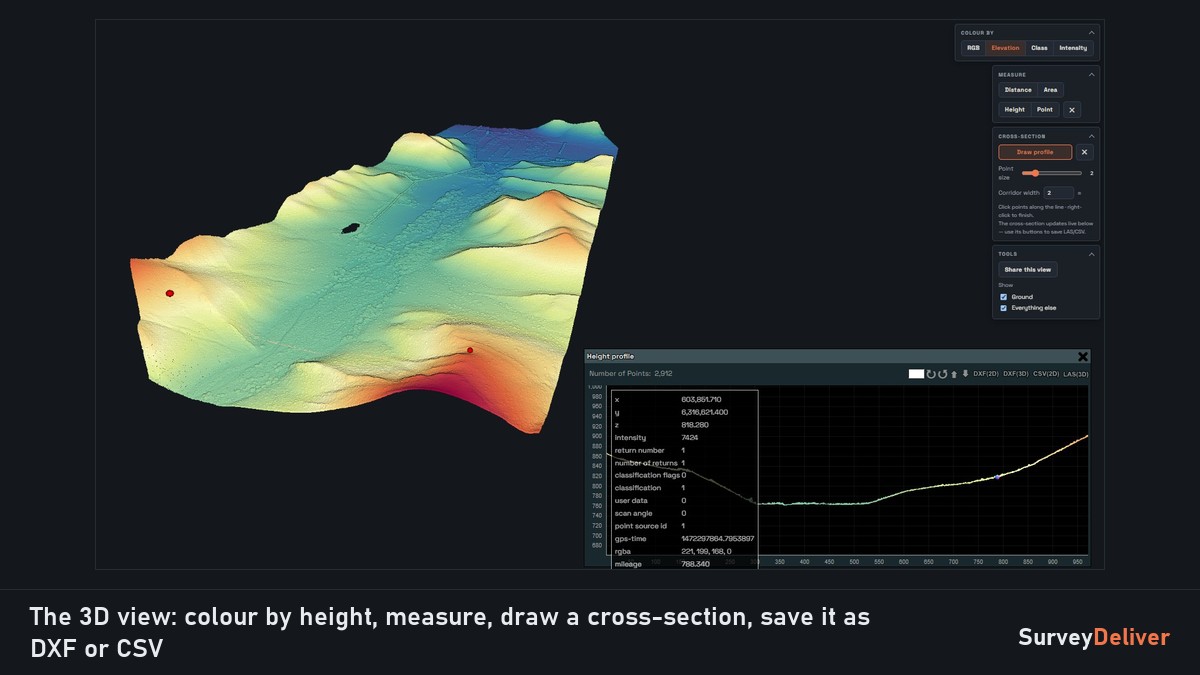
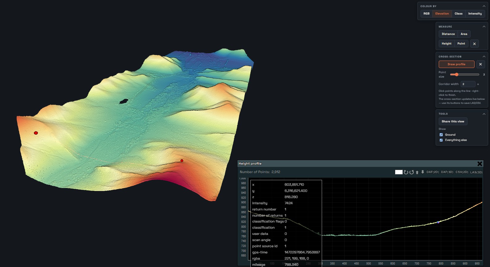
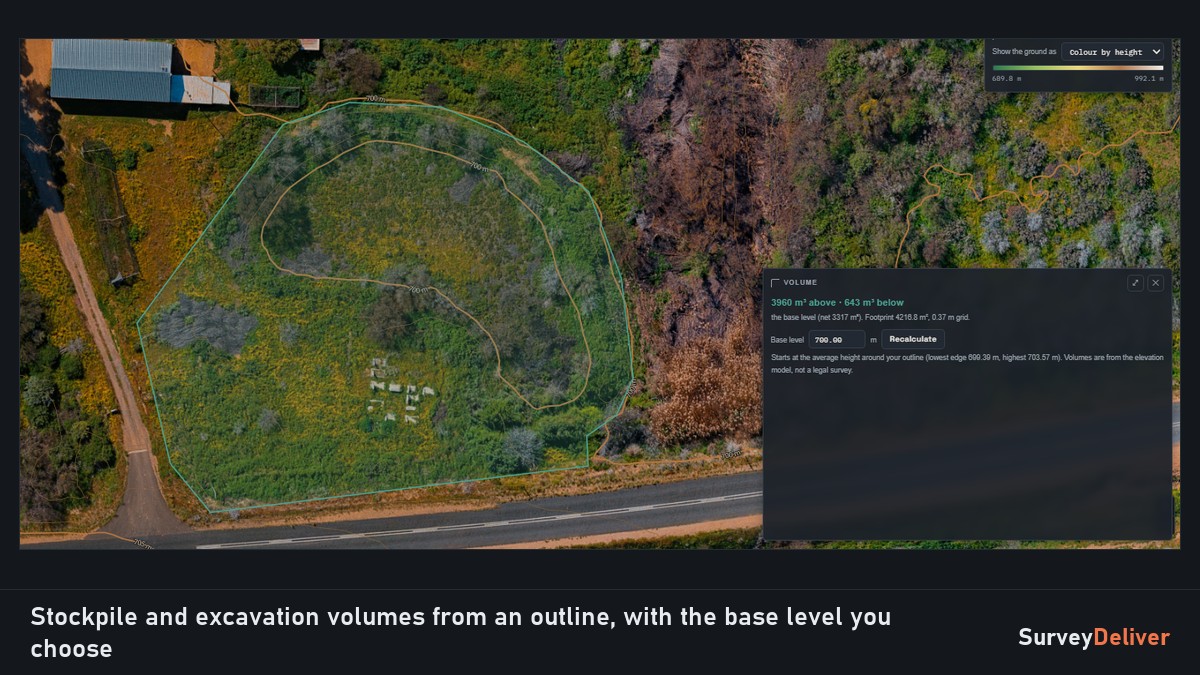
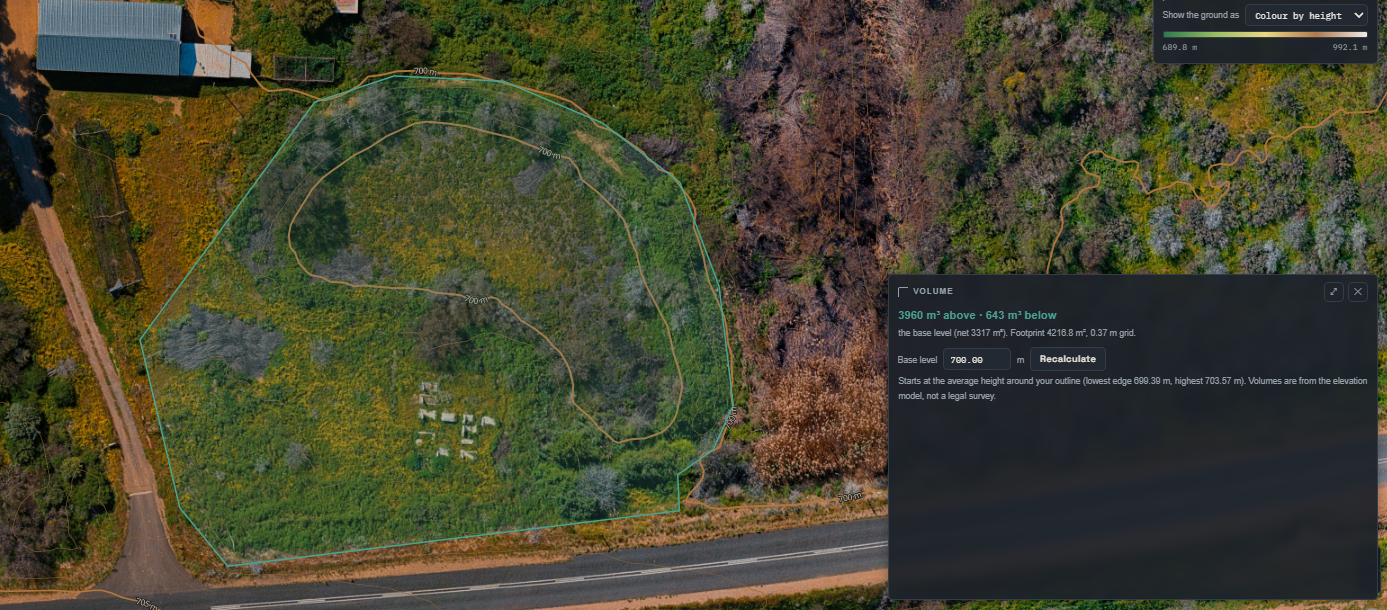
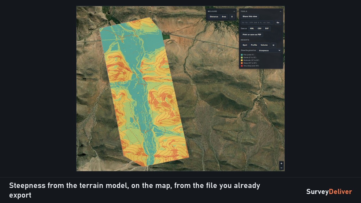
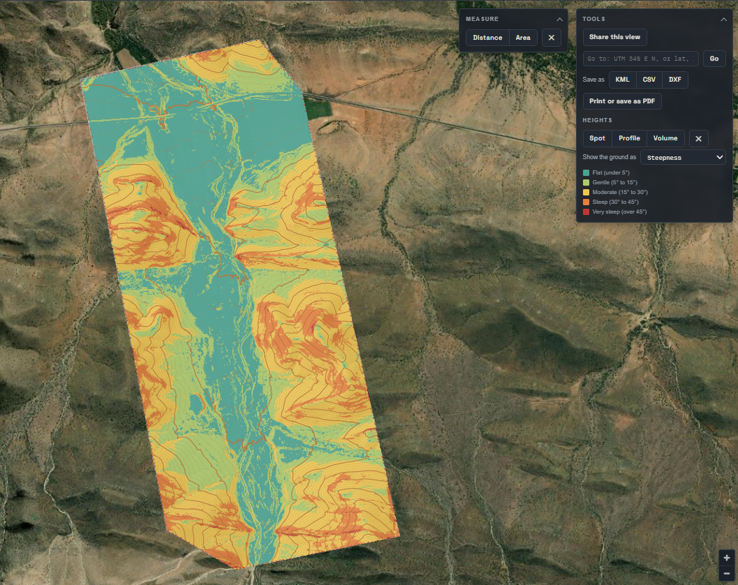
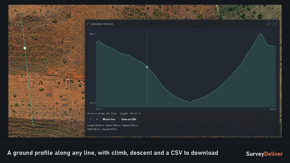
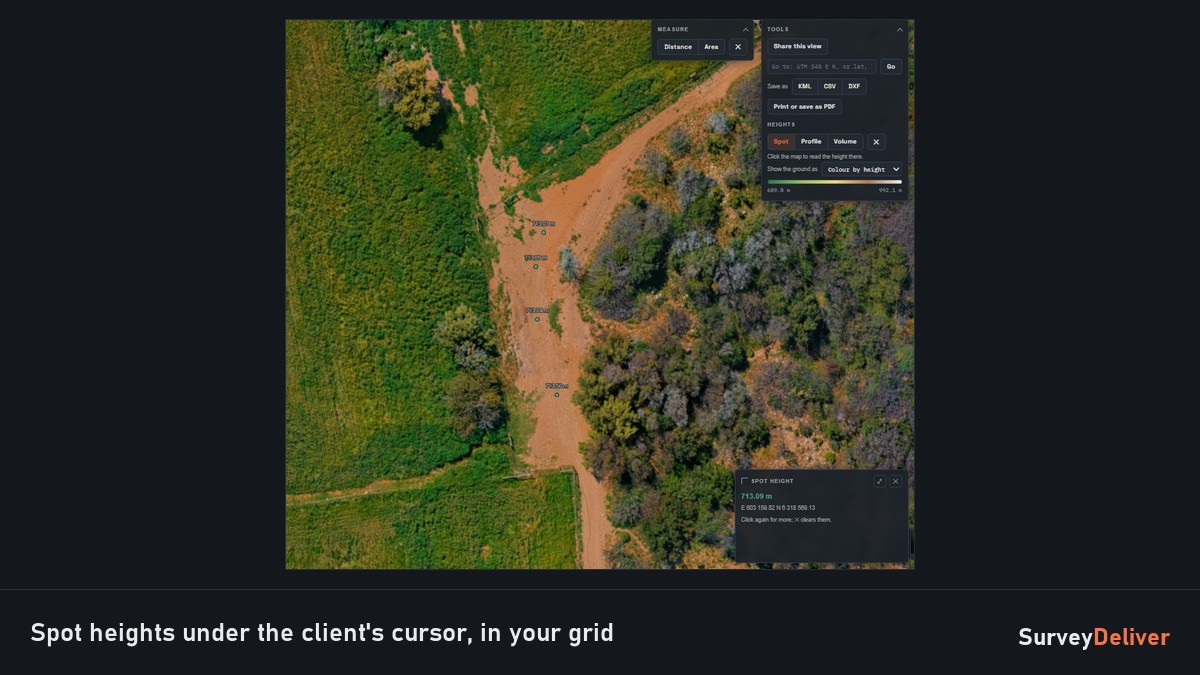
- Gives the client a page with the operator's logo: a map with distances, areas, spot heights, ground profiles, stockpile volumes, steepness and a printable sheet with a title block; a 3D view of the point cloud with colouring by height, class or intensity, measurements and cross-sections; and the downloads. Exports to KML, CSV and DXF in the project's own grid.
- Works straight from DJI Terra, Pix4D, Agisoft Metashape and WebODM, and from any GIS or CAD package that writes those formats.
- Resumable uploads for multi-gigabyte files, optional client logins and expiry dates, the operator's own web address on the higher plans.
Facts
From the founder
“We fly LiDAR for a living. For years the delivery was the weakest part of every job: a download link, a 4 GB LAZ file, and a client asking which software opens it. We built the delivery we wanted to send, and then realised every other operator has the same problem.”
“The check before upload came out of our own mistakes. A site exported in the wrong hemisphere lands thousands of kilometres away, and you only find out when the client phones. Now the file is read on the surveyor's own computer, the footprint is drawn on a map and anything wrong is said in plain words before a byte is uploaded.”
“The client never needs an account or a program. One link, the operator's logo, a map, a 3D view and the downloads. That is the whole delivery.”
Pictures
Captioned versions (1200 × 675) are below; the originals are larger. Click a picture to open it, or use the "original" link.

Boilerplate
SurveyDeliver is the last step of every survey. Operators upload the files they already export: GeoTIFF orthomosaics and elevation models, LAS/LAZ point clouds, shapefiles, DXF and more. The service checks them before upload, converts them for the web automatically and places them correctly, local grids included. The client gets one link with the operator's logo on it: a map they can measure on, a 3D view of the point cloud, and every deliverable to download. No GIS software, no tiling, no web server, nothing for the client to install. SurveyDeliver was built by 3DroneMapping, a drone LiDAR survey company in South Africa, for its own deliveries first.
A full test account, interviews and figures from live projects are available on request: support@surveydeliver.io.