Ready to publish: select all and paste into your editor, or use the Word file. Pictures may be used with the credit "Picture: SurveyDeliver". Questions: support@surveydeliver.io. Press page: surveydeliver.io/press
A South African fixed-wing LiDAR operator on why gigabytes of finished survey data still reach clients as a download link, and what changed when they stopped sending it that way.
By Charlie Wijnberg
We fly fixed-wing drone LiDAR for a living, mostly in South Africa. The flying has become remarkably good, and processing gets faster every year. Yet for a long time our jobs still ended the same way: a download link, a 4 GB LAZ file, an orthomosaic too big for any photo viewer, and a client phoning to ask which program opens it.
Most of our clients are not GIS people. They are farmers, engineers, mine managers, developers and municipal officials. They want to see their site, measure something and pass it on to the next person. A folder of GeoTIFFs lets them do none of that. The last step of the job, the one the client actually sees, was the one that looked least professional.
We have done all four. None of them is a delivery a client remembers for the right reasons.
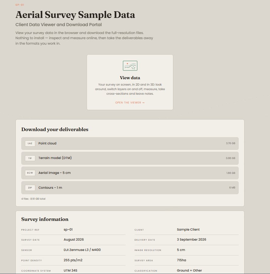
SurveyDeliver started as our own delivery page. We upload the files we already export from our processing software: GeoTIFF orthomosaics and elevation models, LAS/LAZ point clouds, shapefiles, DXF, GeoPackage and KML. The client gets one link with our logo on it: a map they can measure on, a 3D view of the point cloud, and every file to download. Nothing is installed on either side. In October we opened it to other operators.
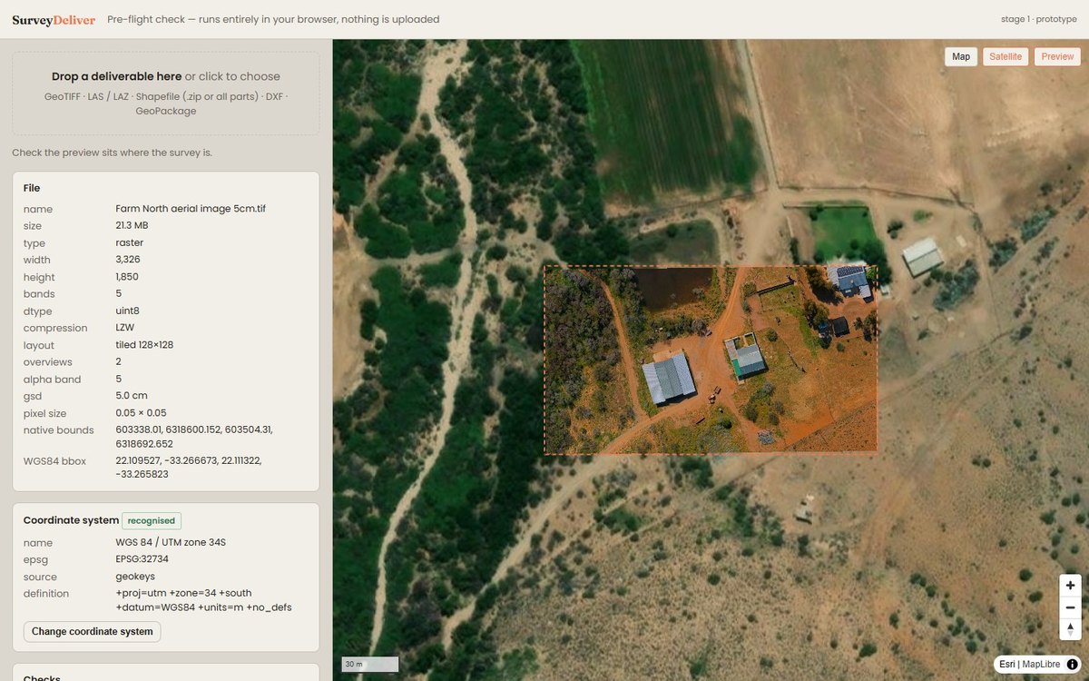
The part I would point other operators to first came out of our own mistakes. A site exported in the wrong UTM hemisphere lands thousands of kilometres from where it should be, and you find out when the client phones. Now each file is read on the surveyor's own computer before anything is uploaded: the coordinate system is found, the footprint is drawn on a map and anything wrong is said in plain words. A file with no coordinate system gets a list to choose from on the spot.
Local grids matter here. South Africa's south-oriented Lo systems, UTM zones and US State Plane all land where they should, and the client reads coordinates in the project's own grid.
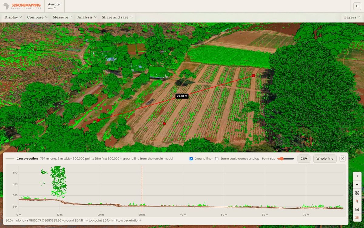
On the map: distances, areas, spot heights, ground profiles and stockpile volumes; a swipe to compare any two layers; a printable sheet with a title block; exports to KML, CSV and DXF in the project's grid. In 3D: the aerial image draped over the shape of the ground, the point cloud coloured by height, class or intensity, and cross-sections. And every original file, for whoever needs it next.
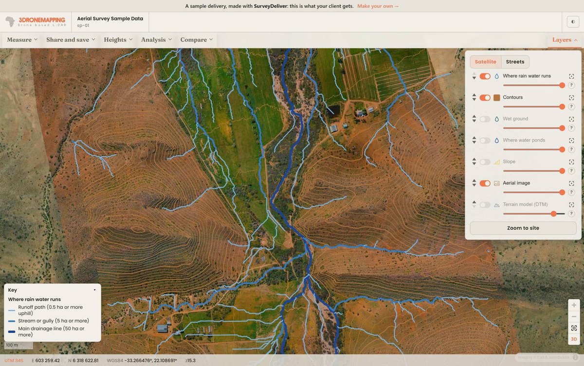
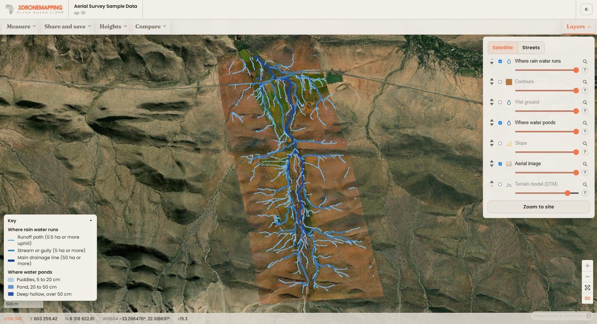
From the terrain model the service works out slope, where rain water runs, where it ponds and the wettest ground, each with a key in plain words. These have turned out to be what clients ask about most: a farmer looking at where water sits after rain, an engineer checking drainage before a design. The operator chooses which ones each client sees.
A 2.4 GB orthomosaic was ready for the web in 11 minutes, a 242 million point cloud in 3 minutes 20 seconds and a 2.6 GB surface model in 15 minutes. Uploads of several gigabytes carry on where they stopped if the line drops, and can be sent straight from the processing computer overnight. It works from DJI Terra, Pix4D, Agisoft Metashape and WebODM, and from any GIS or CAD package that writes those formats.
It does not process imagery or LiDAR. You bring finished deliverables from the software you already trust, and the data stays yours. It is simply the last step of the job, done properly.
A real delivery, a LiDAR survey with a 5 cm orthomosaic, is open to anyone at surveydeliver.io/sample. There is a 14-day trial with no card needed at surveydeliver.io. Plans start at US$29 a month, and accounts started by 30 November 2026 get 30% off their first three months on monthly billing.
Charlie Wijnberg is a LiDAR operator and GIS data specialist at 3DroneMapping, a fixed-wing drone LiDAR survey company in South Africa that built SurveyDeliver for its own deliveries first.